|
|
|
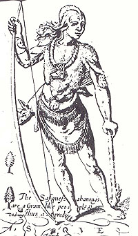
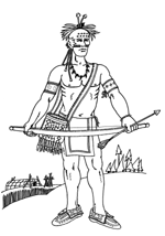
Shamokin’s strategic location along the confluence of the North and West branches made it a hub for merchants and travelers. Looking to the water as their guide, Pennsylvania travelers, particularly the Indians, followed the Susquehanna River because it provided them with a sense of bearing, served as a source of hydration and cleansing, supplied fish, and attracted game. However, contrary to popular belief, the Indians living in Pennsylvania during the seventeenth century did not often rely on rivers or creeks to transport them from one town to another. Dugout canoes made from poplar, sycamore, walnut or elm bark were heavy and cumbersome and since canoe birch, a lighter, more preferred wood did not grow in Pennsylvania, light weight canoes were scarce. Furthermore, the swift, shallow stretches found along the Delaware and Susquehanna Rivers made for difficult and inconsistent travel. What these first inhabitants did use were wooded trails. Pennsylvania’s moderate rainfall and light underbrush created the perfect environment for efficient and dry footpaths. Therefore long before bridle paths, wagon roads, or motor highways were created, Native Americans were marking trails through the woods. These trails enhanced trade, promoted cultural diffusion, and created revenues for battle.
|
According to historian Hilair Belloc, Indian trails were what united the Five Nations and led to their success in battle: a trail “controls development of strategics and fixes the site of battles,” he claimed.
|
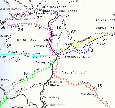
Eleven major Indian paths or trade routes led into Shamokin: The Bottom Path, the Catawissa Path, the Great Island Path, the Great Shamokin Path, the Great Warriors Path, the Paxtang Path, the Penns Creek Path, the Susquehanna Path, the Tulpehocken Path, the Tuscarora Path, and the Wyoming Path. The trails were made level and direct and situated above flood level or along well-drained ridges. In fact the Indians were so successful that even today their courses continue to be mapped and traversed as motorist routes. Yet despite their achievements, the more time efficient transportation introduced by the increasing white population caused many of the trails to become forgotten and worn over by pack horses and wagons. Farming, lumbering, railroads, house building, and strip mining destroyed the once weaving pathways and most signs of these natural highways have disappeared.
Works Cited |
|
|
|
|
/SusquehannaRiver.jpg)