A History
/SusquehannaRiver.jpg)

| Main Page |
| Time Line |
| History |
| Indian Trails and Shamokin (7000 BC-1763 AD) |
| Fort Augusta (1756-1792) |
| Founding of Sunbury (1772-1830) |
| Railroad and Canal Era (1830-1912) |
| Contemporary (1912-present) |
| Maps |
| Indian Trails and Shamokin (7000 BC-1763 AD) |
| Fort Augusta (1756-1792) |
| Founding of Sunbury (1772-1830) |
| Railroad and Canal Era (1830-1912) |
| Contemporary (1912-present) |
| Special Topics |
| Related Links |
| Works Cited |
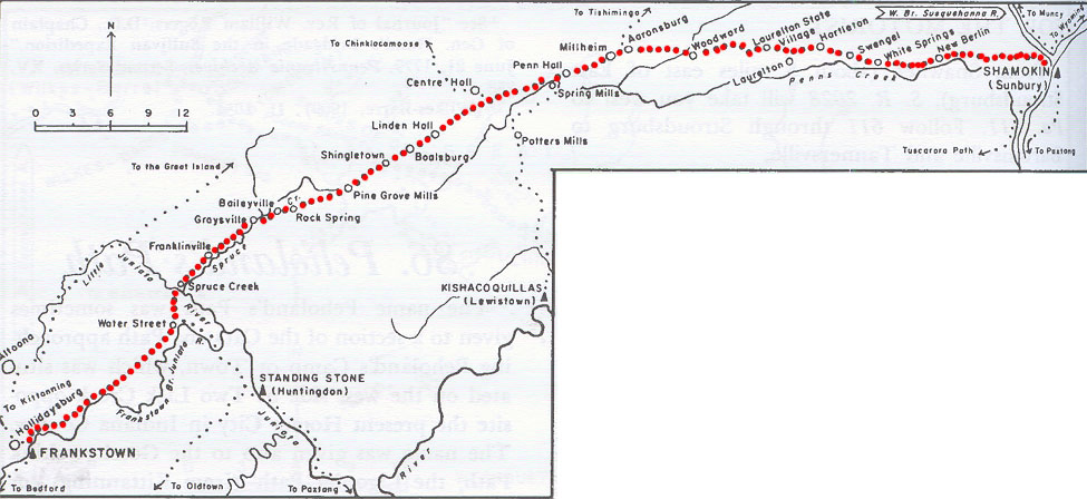
Penn's Creek Path |
||
|
||
The Penns Creek Path is now followed by Pa. 304 from Blue Hill to New Berlin; S.R. 3004 through Swengel; Pa. 45 through Hartleton, Laurelton State Village, Woodward, Aaronsburg, Millheim, Penn Hall, Boalsburg, Seven Stars, Spruce Creek, and Water Street; and U.S. 22 through Frankstown.
|
||
|
||
|
||
|


The Bucknell Environmental Center ▪ 835 Fraternity Road ▪ Bucknell University ▪ Lewisburg ▪ PA 17837▪ (570) 577-1490