


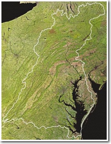
The Susquehanna has two main branches, with the North Branch, which rises in upstate New York often regarded as an extension of the main branch. The shorter West Branch, which rises in western Pennsylvania, is often regarded as the principal tributary, joining the North Branch near Northumberland in central Pennsylvania.
The Susquehanna drains 27,500 square miles (71,225 km²), covering nearly half of the land area of Pennsylvania and portions of New York and Maryland. The river empties into the northern end of the Chesapeake Bay at Havre de Grace, Maryland, providing half of the freshwater inflow for the bay.
In 2003 the Susquehanna River contributed 21% of the sediment, 44% of the nitrogen, and 21% of the phosphorus flowing into the Chesapeake Bay. Pennsylvania may be subject to federal sanctions if it does not reduce its pollution by 2010. In 1997, the U.S. Environmental Protection Agency designated the Susquehanna as one of the American Heritage Rivers.

More work between scientists, farmers, and public agencies is needed to arrive at an accurate assessment of the river and identify ways to improve conditions in the watershed. .