Studies of Roaring Creek have been performed through a long term research and teaching partnership between Bucknell University (Bucknell Environmental Center), Pennsylvania Department of Conservation and Natural Resources (Bureau of Forestry), and the Pennsylvania Institute of Conservation Education (PICE). This research is then compared to graduate and post-doctoral watershed study sites such as Coweeta, Hubbard Brook, and JT Andrews. Watershed hydrology and geomorphology, as well as stream and lake ecology are all studied within this watershed. Roaring Creek is also used as a control site for comparison of watersheds disturbed by mining (AMD). Impacts of forest management practices are monitored here as well. (click on photos to enlarge)
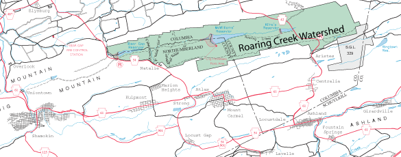
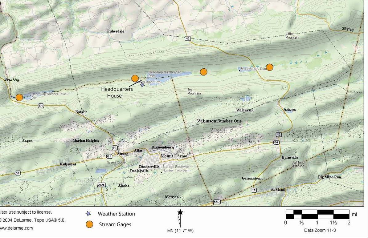
Maps of the Roaring Creek Experimental Watershed. Left shows the Weiser State Forest (shaded). Right is a more detailed topographic map of the watershed showing locations of flow gaging stations and a weather station. More instrumentation will be added as the project grows.
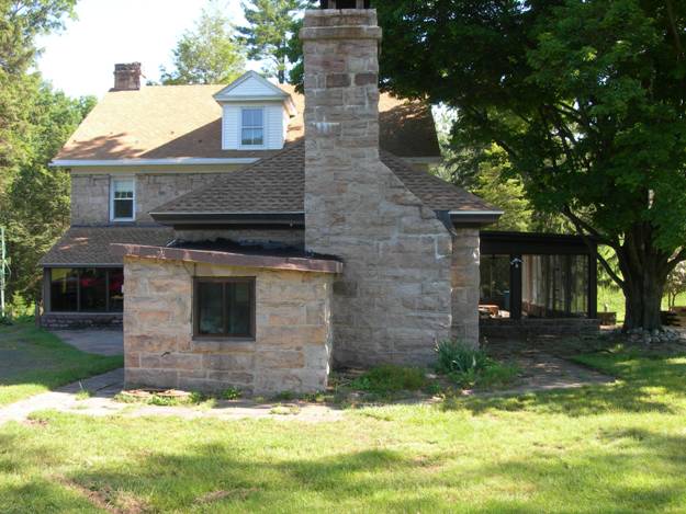
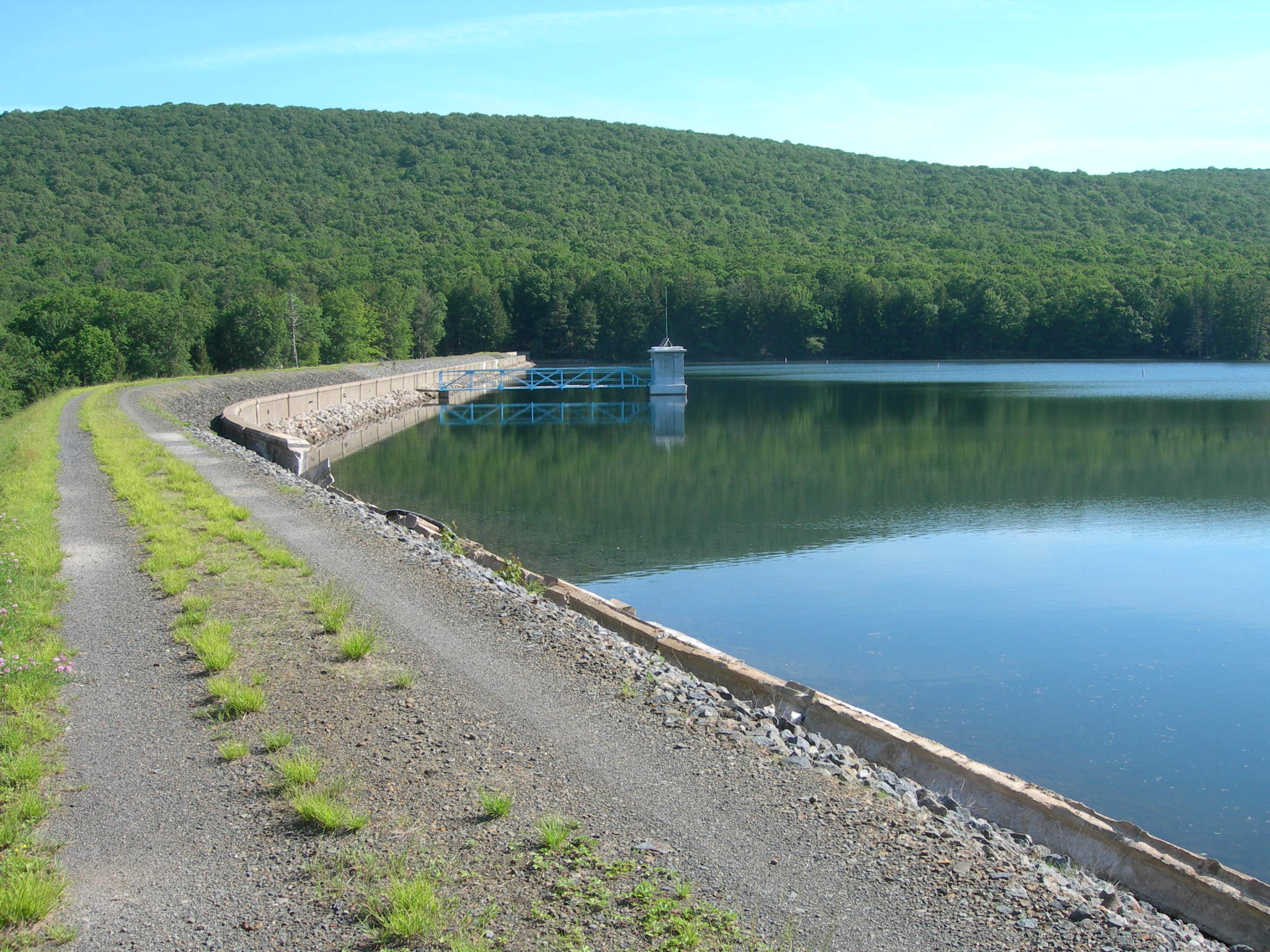
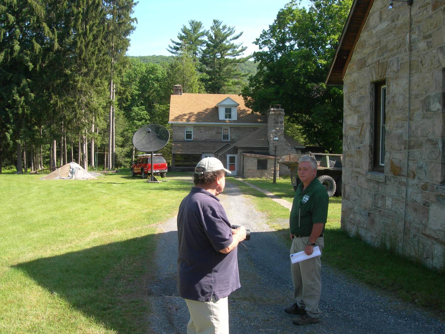
(left) Headquarters house used by DCNR-Forestry and Bucknell for field lectures and short-courses. The stone house will eventually also serve as temporary lodging for short-term field researchers. (center) Dam impounding the middle and largest of the three reservoirs used for water supply. This lake will be the site of limnological studies of lake ecology. (right) Maintenance sheds and headquarters house near the middle reservoir.
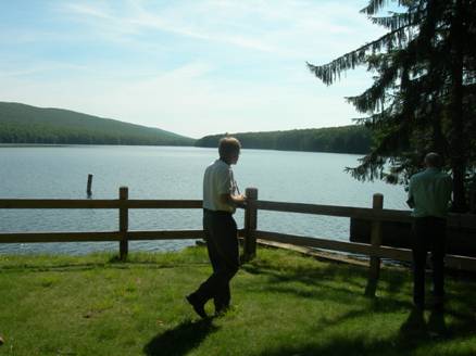
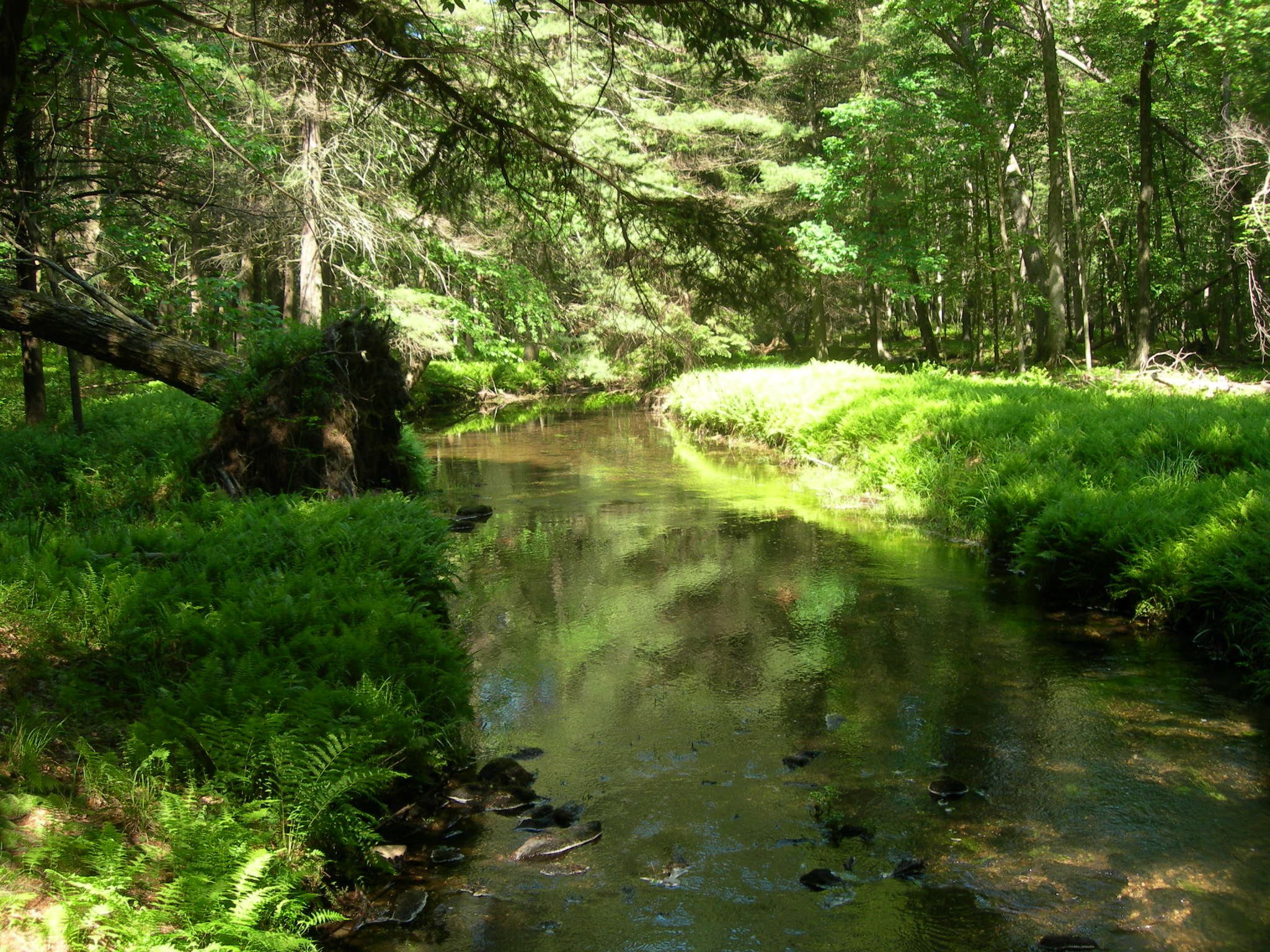
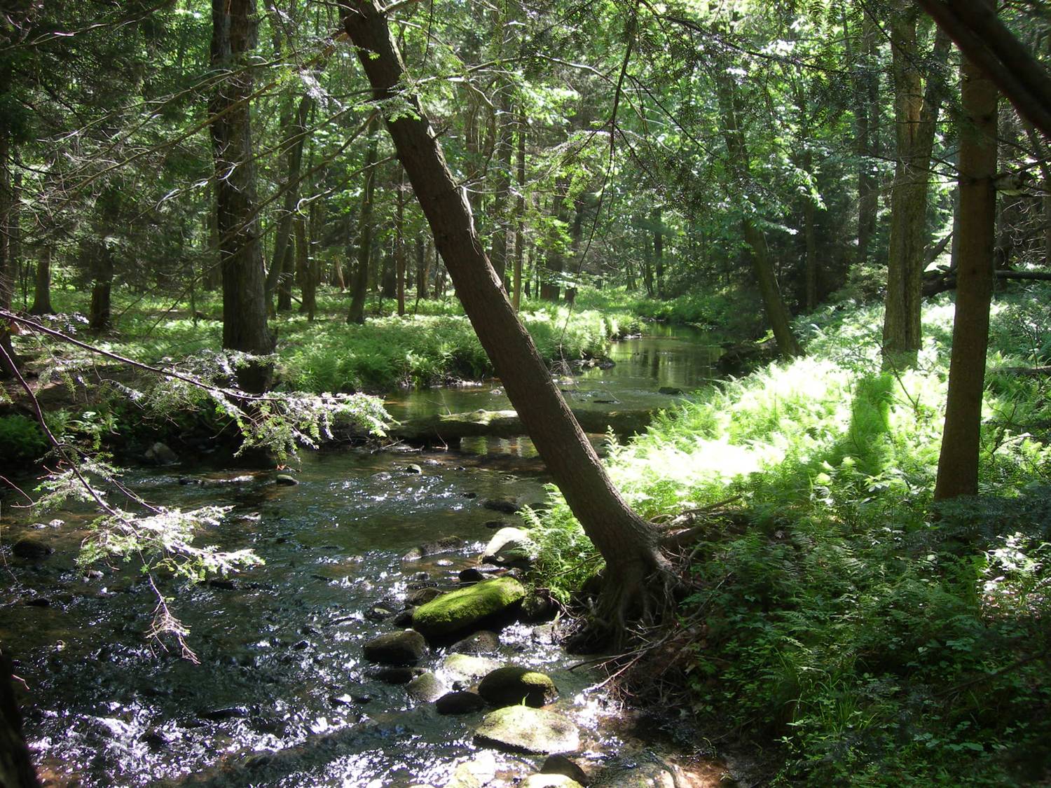
(left) View across middle lake from the A-frame facility used in field instruction by DCNR, PICE, and Bucknell. (center & right) Forested channel of Roaring Creek between the lower and middle reservoirs. This stream will be used to study stream ecology, geomorphology, and hydrology.
Ritter House • 835 Fraternity Road • Bucknell University • Lewisburg, PA 17837 • (570)577–1490
This initiative is funded in large part by a grant from the Henry Luce Foundation.